
Search Montclair Streets by Address
Prince William County records are the practical route for a street-by-street inquiry because Montclair is a county community, not a separate city records jurisdiction. Begin with the exact situs address, meaning the physical property address used by the assessor. The assessor card supplies a parcel lead, but its owner and mailing fields can describe a trust, company, estate, or an out-of-county recipient. Treat each result as a record about property, then verify the event that matters through the clerk or another source.
- Enter the house number and street in PublicAccessNow, then open the result that matches the intended street and community.
- Copy the property address, account number, and GPIN. A GPIN is the county parcel identifier used to connect assessment and map searches.
- Use County Mapper to inspect the parcel and nearby address polygons. Record nearby GPINs as map leads, not as claims about who lives nearby.
- Follow a transfer-history conveyance number into Eagle Recorder. Select Detail Data for the indexed parties, legal description, and related-document links.
- For a dated household clue, consult the historical directory shelf rather than treating the voter-status portal as a street roster. Virginia’s public voter-list access is controlled, and the public portal serves an individual status or polling-place task.
That chain is address, parcel, recorded instrument, and only then a carefully dated directory or other person-specific source. It keeps ownership, mailing, and current presence from being blended into one unsupported conclusion.
Montclair Address Search Fields
PublicAccessNow’s address search is built for a property address, not a general name search. Its form uses House Number, House Number High, Street Name, and Search. The high-number field is useful when checking a range. Enter the street name without a directional prefix or suffix, then compare the returned property address before opening a card. The county’s street directory is a useful check when a similar street name appears elsewhere in Prince William County.
| Field | How to use it | Format or limit |
|---|---|---|
| House Number | Enter the known address number. | Use with Street Name. |
| House Number High | Set the upper end of an address range. | Optional range field. |
| Street Name | Enter the road name for the property search. | No directional prefix or suffix. |
| GPIN or Account# | Use after an address or map search identifies the parcel. | GPIN xxxx-xx-xxxx; account/RPC uses six characters with leading zeroes when needed. |
The PublicAccessNow GPIN search is shown below. It is a good fallback when an address has several close matches or an older document gives the parcel identifier instead of a street number.
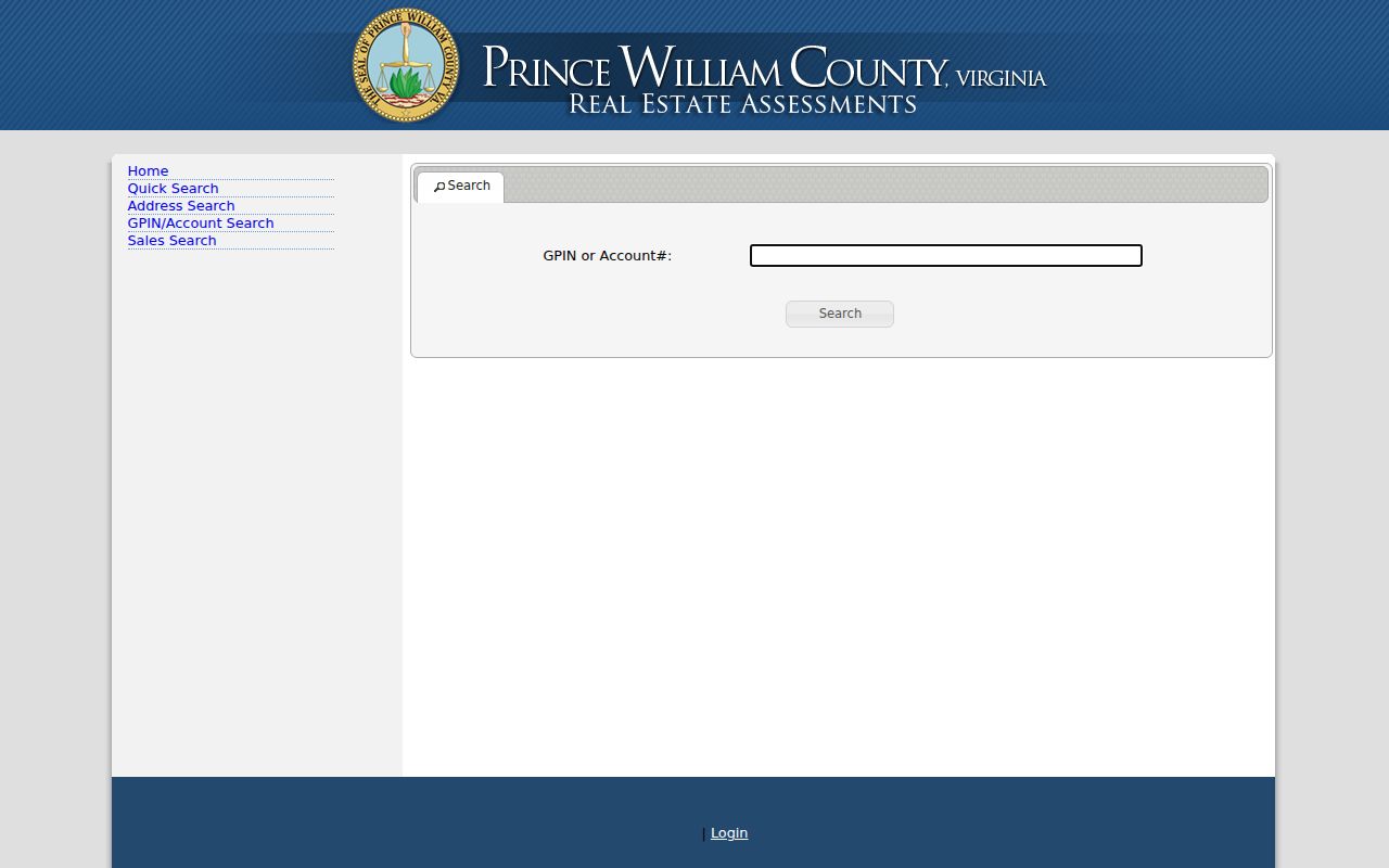
Once a GPIN resolves to the right property card, preserve the exact situs address and account number before moving to map, deed, or plat research.
Note: A ZIP label can help rule out a false match, but PublicAccessNow uses the county address, account, or GPIN as its operational property keys.
Read Montclair Parcel Cards
A parcel is a defined piece of land in the county assessment system. Its card can show Property Address, Account Number, Owner Name, Owner Address, Use Code, description, assessment values, zoning, acres, improvements, assessment history, and transfer history. These fields serve different purposes. The situs address identifies the property; the owner name identifies the assessed owner; and the mailing address tells the county where tax correspondence goes. None of those fields alone establishes current occupancy.
- Parcel
- A county-tracked property unit tied to an account or GPIN.
- Situs address
- The physical address of the property, which can differ from the owner’s mailing address.
- Plat
- A recorded map that can show lots, blocks, roads, and subdivision layout.
- Criss-cross directory
- A reverse-address style directory, when available, used to find historical listings by street rather than by name.
Assessment transfer history is a useful index of date, sale amount, owner, transfer type, and conveyance number. It is not proof of a move. Family transfers, refinances, corrections, trusts, and other non-arm’s-length events can appear there, so the recorded instrument remains the confirmation source.
Map Montclair Street Parcels
County Mapper accepts an address or GPIN and also allows a map click. It can help place a parcel beside roads, streams, Lake Montclair, and other mapped parcels before each address is checked in PublicAccessNow. GIS says owner information in the viewer comes from Real Estate Assessments, so it does not create an independent ownership record. The drawing on screen is informational, not a legal boundary or survey.
Pop-up blockers can suppress parcel information. Cookies and MyMap behavior can affect saved views, and aerial and parcel layers may be slightly misaligned because of their source data. Use “adjacent on the viewer” for a map relationship. For a lot line or legal description, use the recorded plat and deed instead.
Trace Montclair Transfer Records
After a parcel card identifies a conveyance number, search the Prince William Eagle Recorder by instrument number. If that number is unavailable, search a last name or organization, add a first name when useful, and narrow the recorded-date range. Detail Data is the key result view because it exposes all matching names, legal descriptions, and hot links to marginal or related documents. Grantor means the indexed party transferring an interest; grantee means the party receiving it.
The online deed and related land-record index and images reach from 1918 to the present, and plats share that coverage. The index search is available without a login. Occasional online image purchases require registration and payment, with the researched rate of $0.50 per image plus a $2 internet convenience fee. Public terminals in the Circuit Court Clerk’s rooms avoid the login and internet convenience fee, although copy charges apply. Mail requests for certified copies go to the clerk and need a precise document request, payment, and a self-addressed stamped envelope. Check the current clerk fee page before ordering because fees can change.
PublicAccessNow Sales Search provides a separate way to narrow sale records by price, date, year built, square footage, acreage, use code, style, or neighborhood. Its controls are pictured here.
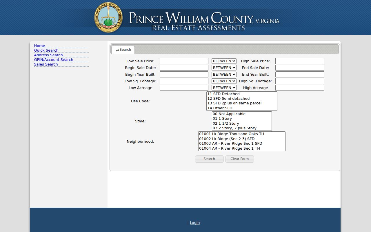
Use the sales filters to understand record patterns along an area, then confirm a particular transfer through the instrument and its legal description.
Prince William County Property Alerts began as a free Circuit Court service in 2025. A parcel owner can subscribe by owner name or GPIN and receive a document type, reference number, recording date and time, and link when a future filing is recorded. A custom keyword alert looks forward, while Find a Document covers only the prior three months. The service monitors recordings, not current occupancy or a final finding of fraud.
Montclair Street Records Table
Each address-keyed source answers a narrower question. The street directory workflow is strongest when the source is kept beside its actual function rather than used as a universal resident list.
| Address record | Custodian or tool | What it can show | Access path |
|---|---|---|---|
| Assessment card | Real Estate Assessments / PublicAccessNow | Situs, owner and mailing fields, values, use code, transfer lead | Free county portal |
| Parcel map | County Mapper | Address, GPIN, mapped parcels, layers, and context | Free viewer, informational only |
| Deed and plat index | Circuit Court Clerk / Eagle Recorder | Parties, recorded date, legal description, and related links | Index online or courthouse terminal; images and copies have channels and fees |
| Permit or case | Development Services ePortal | Construction, land, plan, inspection, code, or hearing activity | Public search by address, permit number, or project name |
| Historical directory | RELIC at Central Library | Dated name or address entry where the volume includes one | Library collection, not proof of current occupancy |
The property account or GPIN is the cleanest link between assessor and map research. The conveyance number then connects the transfer lead to the clerk’s record. A street name alone is less reliable because Prince William County has similar names and changing historical labels.
Date Montclair Lots and Streets
Plats can explain why lots share a road, subdivision, or association layer. Prince William County makes plat indexes and images available from 1918 forward. Match the lot, block, and legal-description wording to the GIS parcel before deciding that two addresses belong to the same development area. For older land, the county’s historical routes and RELIC materials are more appropriate than assuming the online index is complete.
Development Services ePortal offers public searching for construction and land permits, plans, inspections, code cases, and hearings. Address, permit number, and project name are visible search modes. An account is not needed for public search, but it is needed for submissions, inspection scheduling, or viewing one’s own cases. A permit dates work or an administrative event. It does not identify the person who ordered work or prove that anyone lived there.
Note: If a public ePortal result only supplies a case number or title, request the underlying public file from the appropriate custodian instead of inferring details.
Montclair Precinct Street Layers
The Montclair POA precinct list divides the community into four precincts and assigns streets to each. The POA’s public subassociation material adds street coverage for Alexander Square, Northside, Southlake, Island, Nob Hill Forest, Southlake Landing, and Water’s Edge. Those layers can explain a neighborhood label or a street grouping. They are organizational context, not a public membership or resident roster.
Use codes are another useful check before reading every mapped polygon as a house. The assessor’s live list includes 92 for private open space owned by an HOA, 93 for private streets owned by an HOA, 720 for civic or social associations, 950 for permanent conservation area, and vacant-land categories such as 971 and 972. Those parcels can interrupt a block, sit beside homes, or carry an association owner field without representing a household.
Aerial Clues for Montclair Streets
County Mapper’s historic aerial options include 1937 and a series from 2004 through 2023. The 1937 layer shows land use before Montclair was established in 1969, while later imagery can help date visible road, tree, or building changes. It is useful context for a plat or permit timeline, especially where a street follows the outline of an earlier tract.
Aerial pixels do not prove a legal boundary, an owner, or a named occupant. Pair an image observation with the parcel card, recorded plat, permit record, or deed. No official Montclair street-renumbering order was identified in the research, so use exact street name, house number, ZIP or community, and the parcel record rather than inventing a renumbering explanation.
Avoid Montclair Street Mismatches
The county street directory lists Montclair examples such as Widewater Drive, Windsong Lane, and Windward Court with the 22025 postal label, but it also contains similar names associated with nearby ZIPs including 22172 and 22193. Match house number, full official street name, ZIP or community, and parcel before treating a result as Montclair. An older directory may use Dumfries, Quantico, Triangle, or another regional label without proving the modern address is the same.
For post-1969 addresses, start with the current parcel and move backward through transfers, plats, and dated directory entries. For pre-1969 land, identify the earlier tract, road, or county context first. This avoids placing a modern Montclair address in a period before the community existed.
Montclair Street Directory Limits
A Montclair street directory can point to property and dated record trails, but it cannot supply a reliable live household list. Assessment ownership, mailing information, a deed party, a directory entry, or a map polygon each describe a different record relationship. Virginia voter records have controlled public-list rules, and the public Citizen Portal is not an address-by-address directory. Protected addresses, sealed material, juvenile records, vital records, and DMV information have separate limits.
Use the public data for personal, lawful research such as family history, estate matters, or checking a property record. Keep sensitive details out of notes, confirm conflicting records with the custodian, and do not attempt to identify protected addresses.